Hi,
I have a question about route accuracy in you app. Currently I’m using build in courses in my watch and sametimes dwMap, but both of them have low route accuracy. When I upload 100km+ route, some turns are cut out and it’s difficult to navigate mainly in the cities or other places with complicated crossroads.
Hi, and welcome. The route lines are simplified slightly using a common smoothing algorithm when they’re downloaded to the watch to reduce the number of points . It’s likely this which is losing some of the route fidelity, especially over larger distances.
The points are smoothed to reduce the memory consumption of the running application and to prevent the download being too large.
If you have an example route file I can take a look at it and see if there’s some problem we can fix.
Can you tell me the maximum number of track points after smoothing. So I can split the track manually to be sure that I have maximum accuracy? Or maybe all tracks are simplified regardless it’s complexity and distance?
Of course it would be nice to have optional auto splitting, and auto switching feature to have maximum accuracy, but in the past I used manual splitting and phone navigation in most problematical places.
Routes are simplified until they have at most 200 points. Anecdotally, I’ve used routes up to 50k and not noticed an issue (I know this because it was an issue and I fixed it).
If you share a route and highlight a location which is an issue I can see whether there’s a good way to solve for this.
Thanks for info. I have this issues in my build-in navigation and dwmap. I didn’t try mappily yet. I ask this question before installing. Now I’ll try mappily and in case of same problems I will let you know.
50k+ route sounds promising.
I’ve tried 40km route (exported from history so I’m sure that I follow same roads) and I have many off-route messages and couple truncated turns. Egzample in screenshot (don’t look on arrows, I was riding in reverse direction).

Thanks for testing. Can you please share the GPX file here or email it to user-support@mappily.info. Those discrepancies are too large to be smoothing, so I’d like to check what’s happening there.
Hi - I’ve looked into this and I’m able to recreate this problem using this GPX file. Was it created using an activity track by any chance?
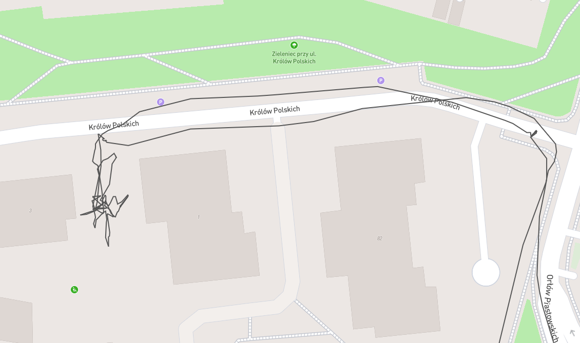
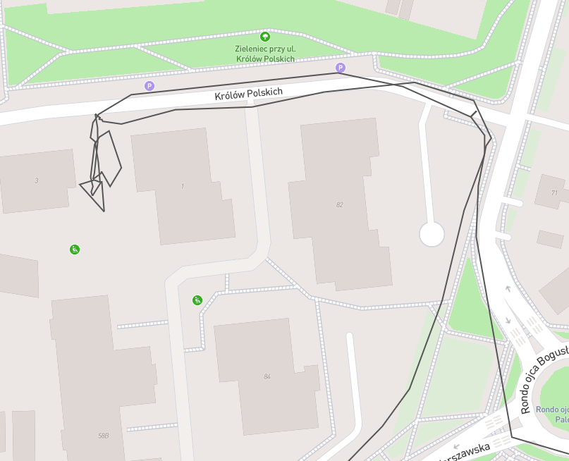
The GPX file contains over 3000 points. When the application tries to simplify it, it can’t decide the most important sections to keep, so you lose a lot of detail in the long straight sections.
For example, you can see in the screenshot there are hundreds of points in just this one small area near some buildings. Once it has simplified it, lots of the detail is left in this area, sacrificing detail in other, motr important sections
Try recreating the route in Strava, RideWithGPS or some other tool and re-uploading it to the website. You should find it works a lot better.
It was copied from my previous activity. I will try to recreate it and upload.