First of all, thank you for developing and maintaining this app; it brings tremendous value to navigation on Garmin devices that lack native mapping features.
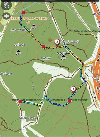
I would like to suggest a feature enhancement regarding route rendering: adding an option to display terrain slope directly on the route line using a color gradient when following an imported GPX track.
Could this be possible? Having the route line colored by inclination allows athletes to assess upcoming terrain profile at a quick glance without needing to switch data screens while doing the activity.
Thank you for considering this addition, and keep up the great work on the application!
It could make sense to highlight the steepest gradients in a colour, but we’d have to experiment a little to ensure it wasnt confusing due to the limited colour palette.
You can enable the profile view om the map screen which might be a better way to display it, with pf without colour